Sights to See in Oregon's Outback
North Lake County
 View from the top of Ft. Rock overlooking Christmas Lake Valley. Photo courtesy of T. Johnson
Hole-in-the-Ground
Heading South on HWY 31 from LaPine, the first stop is Hole-in-the-Ground, a large crater nearly 1 mile across and 300 feet deep. Although it closely resembles a crater caused by a meteor strike, it is thought to be the result of volcanic activity simply because it lacks the metal fragments found in meteor strikes.
Fort Rock & Christmas Valley
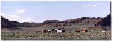 The second stop is Fort Rock State Park. This landmark is a large remnant of a volcano that once rose from the valley floor. It towers 325 feet above the desert floor and is about a half mile wide.
In 1937, a prehistoric shoe made of Sage Brush was discovered at a cave at Fort Rock by a group from Oregon State University.
The Fort Rock Valley Museum is not far away and is a community project to preserve Christmas Valley's history.
Photo Slide Show of the Fort Rock Historical Society Museum and North Lake County sights of interest.
Article of interest: "How Christmas Lake Got Its Name"(http://www.oregonsoutback.com/sights/lore.html)
Crack in the Ground
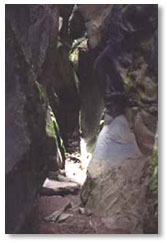 Photo by Paul E. Denny
Crack-in-the-Ground is a large, deep fissure approximately 2 miles long and 70 feet deep. It is uncommon for such rifts to remain open, which makes Crack-in-the-Ground and unusual landmark. It is estimated that it has remained open for a thousand years.
Article of interest: "Crack-in-the-Ground - Nature's Accident" (http://www.oregonsoutback.com/sights/lore.html)
The Lost Forest
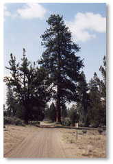 The Lost Forest is an area of ponderosa pines almost 9,000 acres in area. It is 35 miles from the nearest forest. This area has been established as a research area to study and preserve the unique pine forest. Although open to the public, vehicles are restricted to roads and trails within the forest.
Maps of the Christmas Valley area are available at the Christmas Valley Chamber of Commerce, or the Lake County Visitor's Center in Lakeview.
Summer Lake
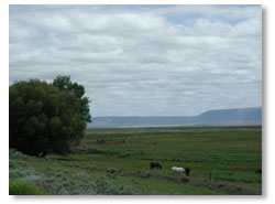 Photo by E. Lasater
Summer Lake Wildlife Area is approximately half way between the turn off at HWY 97 and Lakeview. It is a good place to stretch ones legs and view the local birds and wildlife. A state rest area is across from the local store and gas station and a mile south is the restaurant and hotel. Summer Lake is a large, shallow, alkali lake, not suitable for fishing, but excellent for birds. This is a popular place in the fall for duck and goose hunters.
Winter Rim was named by John C. Fremont, who also gave Summer Lake its name. This mountain range extends 25 miles along the west side of the highway above Summer Lake.
South Lake County
Abert Rim
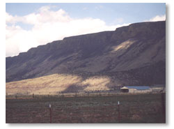 Photo by Paul E. Denny
Abert Rim and Abert Lake lay about 20 miles north of Lakeview. Abert Rim is a large fault block escarpment and stands guard over the valley floor. It is the highest exposed fault in North America and stretches for 50 miles.
Brine shrimp are plentiful in Abert Lake and, as a result, it is a very good place to observe a wide variety of water birds. It is not uncommon to see mule deer traversing the mountain and country side in this area.
Deep Creek Falls
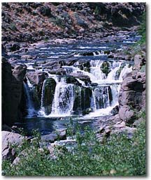 Photo by E. Lasater
As you travel through the Warner Mountains from Lakeview to Adel, you will drive by Deep Creek Falls. It is a beautiful picture in winter as the water turns to ice.
Some caution is needed when stopping to observe the falls, which is located on a curvy road with limited roadside shoulder for parking.
Hart Mountain
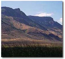 Photo by E. Lasater
Hart Mountain is another large fault block ridge that is approximately 30 miles to the east of Lakeview. At the base of the mountain lies the Warner Wetlands. This is an ideal place for observing waterfowl and other wildlife. A developed trail leads 1/2 mile into the wetlands to a bird blind.
On the top of the mountain is the Hart Mountain National Antelope Refuge. While the pronghorn antelope make their home on the rolling, sage covered plains, bighorn sheep are at home along the mountains ridge.